Historically, urban planning has been a challenging jigsaw with many players vying to design effective, long-lasting, and aesthetically beautiful cities. The comprehension of spatial complexities was restricted by the old planning methods, which frequently depended on two-dimensional representations. The advent of 3D Geographic Information Systems (3D-GIS), which provide an all-encompassing and immersive method of urban planning, has completely transformed the profession.
Understanding the Power of 3D-GIS
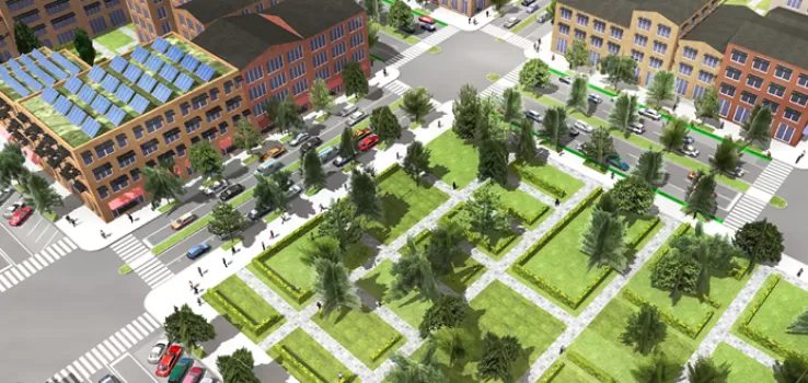
Urban landscapes can be perceived more holistically by planners, architects, and decision-makers thanks to 3D-GIS, which combines geographic data with three-dimensional visualization. Urban planners are able to see the urban environment with a level of depth and understanding never before possible by adding geographic data layers to a 3D model. Buildings, infrastructure, terrain, land use, and even demographic data may all be visualized in a coherent, geographically correct manner thanks to this technology.
Enhanced Decision-Making
The ability of 3D-GIS to support data-driven decision-making is one of its main advantages in urban planning. Planners can evaluate the effects of different situations, including planned developments, modifications to the infrastructure, or changes to zoning laws, on the urban environment by simulating them. Prior to implementation, this predictive capability aids in assessing the viability and possible results of various tactics, ultimately resulting in more informed decisions.
Community Engagement and Communication
Better communication between stakeholders and the general public is encouraged by the immersive aspect of 3D GIS. Comprehending suggested modifications within an authentic three-dimensional setting facilitates community comprehension and feedback on plans for urban development. Design principles that are more sustainable and community-focused result from this inclusive approach, which promotes involvement and openness in the planning process.
Improved Design and Efficiency
3D-GIS is incredibly helpful to designers and architects since it makes design iterations more precise. Designers can maximise layouts for effectiveness, usability, and aesthetic appeal by visualizing structures and their interactions within the framework of the current urban fabric. Furthermore, rework is minimized and time and resources are saved when such problems are found early in the planning process.
XR Studios’ Innovations in 3D-Based Applications
XR Studios is at the forefront of developing innovative 3D-based solutions for a variety of industries, including urban planning, in this age of rapid technological advancement. Urban environment planning and conceptualization are being revolutionized by XR Studios, which is utilizing mixed reality (MR), virtual reality (VR), and augmented reality (AR).
Through the use of cutting-edge technology and user-friendly interfaces, their creative approach enables planners and stakeholders to engage with urban models in immersive virtual worlds. Through collaboration with experts in urban planning, XR Studios hopes to improve the precision and effectiveness of planning procedures while encouraging increased community involvement.
Conclusion
The way cities are planned, run and experienced has undergone a dramatic paradigm shift as a result of the incorporation of 3D-GIS technology. The future of urban development is being reshaped by its capacity to offer a thorough understanding of urban environments, enable data-driven decision-making, and promote community involvement. Future generations could benefit from more resilient, inclusive, and sustainable cities because of the collaboration between technology and urban design, which is being spearheaded by XR Studios.
In summary, the development of 3D-GIS technology has changed urban planning and allowed for the emergence of cutting-edge applications that are altering how we plan and construct cities. The commitment of XR Studios to developing immersive 3D-based apps is set to further transform the industry, offering more effective, entertaining, and progressive approaches to urban planning.


